 |
The Upper Mississippi River Navigation Charts cover the Upper Mississippi River from the head of navigation at river mile 866 in Minneapolis, Minn., to the confluence with the Ohio River at Cairo, Ill. The navigable portions of the Minnesota and St. Croix Rivers are also included. The charts were last updated in 2020. They are available to purchase in hard copy format online from the Government Printing Office (GPO) Bookstore, and digital copies are freely available for download.
|


|
 |
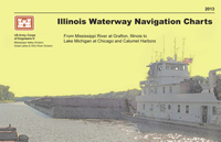
The Illinois Waterway Navigation Charts cover the Illinois Waterway from the confluence of the Illinois and Upper Mississippi Rivers to Lake Michigan at Chicago and Calumet Harbors. The charts have been updated in 2013. They are available to purchase in hard copy format from the Illinois Waterway (at Starved Rock Lock & Dam) and Mississippi River (at Locks & Dam 15) Visitor Centers, and digital copies are freely available for download.
|


|
GEOSPATIAL PDF
A Geospatial PDF refers to a Portable Document Format (PDF) with certain geospatial encoding that relates a region on a PDF document page to a region in physical space. The establishment of this relationship is a process called georeferencing. The georeferencing metadata in the provided files uses the Adobe PDF 1.7 specification for writing geospatial PDF files.
The creation of Geospatial PDFs has enabled the 2011 Upper Mississippi River and 2013 Illinois Waterway Navigation Charts to be imported into location aware applications.
Avenza Systems’ free mobile application called PDF Maps allows users to download USACE chart files and view them on an iOS or Android device and received real time GPS locations. The Atchafalaya River, the Lower Missouri River, and the Upper Mississippi River Charts are currently available in the application store.
NOTICE: These Geospatial PDF Navigation Charts are provided for informational purposes only. They do not meet criteria as navigational products suitable for navigation.
For more information, including limitations, visit Avenza Systems’ Website - http://www.pdf-maps.com/
United States Government (the Government) is not affiliated with Avenza Systems. This program was not created by the Government. The Government recommends that the recipient use this computer program and USACE Geospatial PDFs with the expressed understanding that the Government makes no warranties, expressed, or implied, concerning the accuracy, completeness, reliability, usability, or suitability for any particular purpose of the information. The United States shall be under no liability whatsoever to any person or organization by reason of any use made thereof.
Questions or comments on this content, click HERE